Sick Accuracy Navigation Lidar
Brand: BONRAY
Product origin: China
Delivery time: 30 days after receiving advance payment
Supply capacity: 1000 sets/day
1.Small and exquisite laser radar, convenient for installation.
2.Super fast scanning speed for AGV lidar.
3.The navigation lidar has outstanding and stable performance with the first grade design.
4.IP 65 protection level, special temperature drift error elimination and EMC designs.
6.Up to 16 groups can be defined for the laser radar's detection area.
The robot navigation laser radar adopts working principle of infrared laser which includes near-infrared laser and mid-infrared laser. It can be categorized into visible and invisible. The robot navigation laser radar uses the laser to measure the distance to the target accurately. The laser rangefinder emits a pretty thin laser beam to the target and the photoelectric element receives the laser beam which is reflected by the target. Specifically, the laser beam is finally received by range finder of the AGV lidar, then the range finder records the total traveling time of the laser. The distance between the AGV lidar and the target is half of the result from the speed of light times the total travelling time. The robot navigation laser radar has fast respond speed, compact design, high maximum output power and repetition frequency with large scanning range.
As the pulsed laser ranging technology of this mini lidar, the energy value of the pulsed light is 1000 times higher than the constant light source. It can ensure the stable measurement. This navigation lidar adopts the innovated nanosecond narrow pulse technology which is harmless for human eyes. All of the laser radars we produced reach the international advance level. It has various of optional scanning radius which are 6m, 10m or 20m. This first level laser radar's scanning angle is 270 degrees and the reflect rate for white object is 70% with the working principle of optical two-dimensional detection.
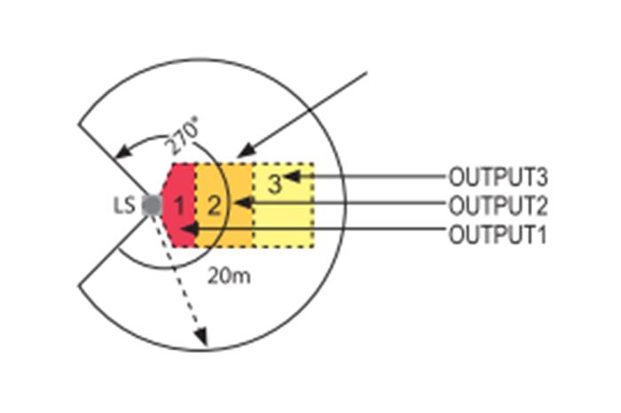
- Advantages of the robot navigation laser radar:
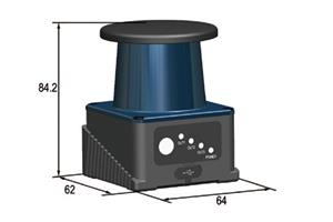
1.Small and exquisite laser radar, the size is 62mm*64mm*84.2mm which is convenient for installation and more space can be saved.
2.The scanning speed of the mini radar is super fast that it can measure up to 25000 times per second. Its scanning time of a single circle is 40m/s.
3.The navigation lidar has outstanding and stable performance with the first grade design.
4.IP 65 protection level, special temperature drift error elimination and EMC designs for the mini lidar. All of them have passed the ambient light, shock and vibration tests.
5.The parts of the AGV lidar are detachable that is convenient and has lower expense for maintenance. It also greatly improves the service time.
6.Up to 16 groups can be defined for the detection area. The detection area of the AGV lidar can also be customized for any complicated or unusual shapes and sizes according to customers' requirements.
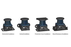
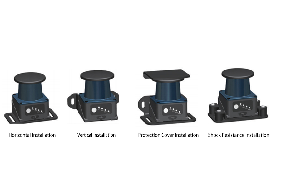
-Methods of laser radar installation:
-Parameters of navigation lidar:
Scanning Angle Range | 270 degree |
Maximum Protection Area Radius | 20m 70% reflection rate (white object)/8m 10% reflection rate (black object) |
Angle Resolution | Obstacle Type:0.5 degree Measure Type:0.33 degree |
Applicable Temperature | -10 Celsius-55 Celsius (working) -40 Celsius-70 Celsius (storage) |
Applicable Humidity | 35% RH-85% RH (working) 35% RH-95% RH (storage) |
Laser Source | 905Wave Length (first grade product) |
Measurement Error | Basic Type: ±4 cm High Precise ±2cm |
Anti Light Interference | 15000 Lux |
Anti Vibration | Frequency: 10HZ-55HZ Amplitude:0.35mm±0.05mm Scanning Times:3 axis, 20 times for 1 axis |
Impact Resistance | Acceleration:10g Pulse Duration:16m.s Collision Time: three axis, 1000±10 times every axis. |
Size | 62mm*64mm*84.2mm |
Power Voltage | DC9V-DC30V |
Protection Level | IP65 |
Power Rate | 3W |
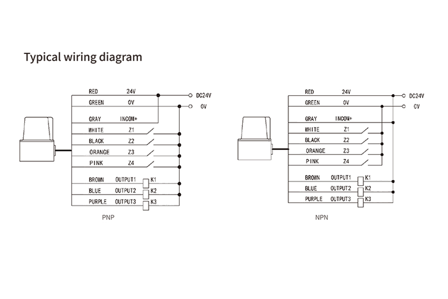
-Use of robot navigation laser radar:
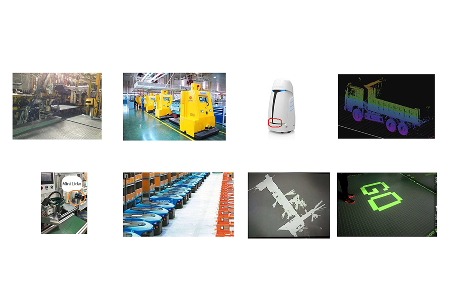
The robot navigation laser radar is widely used in AGV navigation, obstacle avoidance, service robots, three dimensional garage, intelligent storage, unmanned driving, intelligent security, contour scanning, volume measurement, area protection, smart cities and interactive projections, etc.
